
About Mindanao
Mindanao is the second-largest island in the Philippine archipelago and the anchor of the southern island group that bears its name. It includes six administrative regions spanning 28 provinces, and takes in the Sulu Archipelago and the Tawi-Tawi island chain extending toward Malaysian Sabah, with its largest islands being the Mindanao mainland, Basilan, Jolo, Tawi-Tawi, and Dinagat.
The geography of Mindanao is defined by extremes: the volcanic peak of Mount Apo, the surf breaks of Siargao, the highland farms of Bukidnon, the tuna-rich waters off General Santos, and the seagrass beds of Tawi-Tawi.
Mindanao is home to some of the Philippines' most distinctive natural and cultural landmarks, including the Philippine Eagle Center, the volcanic island of Camiguin, Lake Sebu's T'boli culture, and the sacred Lake Lanao. The administrative map has shifted in recent years, most notably the 2025 transfer of Sulu from BARMM to Region IX under Executive Order 91.
Beyond travel, Azifind also lists businesses across Mindanao's regions, including restaurants, hotels, healthcare providers, financial services, retail businesses, transportation services, attractions, and other local service providers.
Geographic Facts
Total Land Area
Mt. Apo (Highest Peak)
Major Islands
Provinces
Major Islands
Mindanao
The mainland island and second-largest in the Philippines, home to Mount Apo, Davao City, and the vast majority of the island group's population.
Basilan
Lies southwest of Zamboanga City, part of BARMM, known for rubber and coconut plantations and its coastal Yakan communities.
Jolo
The main island of the Sulu Archipelago, historic heartland of the Sultanate of Sulu and the Tausug people, transferred to Region IX in 2025.
Tawi-Tawi
The southernmost province of the Philippines, an island chain with extensive seagrass beds and sea turtle nesting grounds near Malaysian Sabah.
Dinagat
A group of islands off northeastern Mindanao in Caraga, known for its karst landscapes and as a significant nickel mining area.
Camiguin
A small volcanic island off Northern Mindanao known as the Island Born of Fire, home to seven volcanoes and the Sunken Cemetery.
Siargao
A teardrop-shaped island in Surigao del Norte, the surfing capital of the Philippines and home to the legendary Cloud 9 break.
Bordering Waters
Bohol Sea
Separates Mindanao from the Visayas
Surigao Strait
Between Caraga and Leyte
Philippine Sea
Pacific-facing coast, home to Siargao's surf breaks
Davao Gulf
Bounded by Davao Region and Davao Oriental
Celebes Sea
Southern boundary toward Indonesia
Sulu Sea
Between Mindanao, Sulu, and Palawan
Moro Gulf
Between Zamboanga Peninsula and the BARMM mainland
Sarangani Bay
Sheltered bay off General Santos and Sarangani province
Mindanao Regions
All 6 administrative regions, each linking to a complete provincial and city-level directory with attractions, festivals, restaurants, and local food.
Zamboanga Peninsula
Region IX
Anchored by Zamboanga City, the City of Flowers, a melting pot of Christian, Mus...
Northern Mindanao
Region X
Centered on Cagayan de Oro, the City of Golden Friendship and the main gateway t...
Davao Region
Region XI
Home to Davao City, the largest city in the Philippines by land area, and Mount...
SOCCSKSARGEN
Region XII
The tuna capital of the Philippines, centered on General Santos City, a major ex...
Caraga
Region XIII
Occupies the northeastern corner of Mindanao, home to Siargao Island and the leg...
Bangsamoro Autonomous Region in Muslim Mindanao
BARMM
The only Muslim-majority autonomous region in the Philippines, governed under it...
Best Tourist Spots in Mindanao
Volcanic landmarks, surf breaks, waterfalls, and cultural lakes spread across Mindanao's 6 regions.
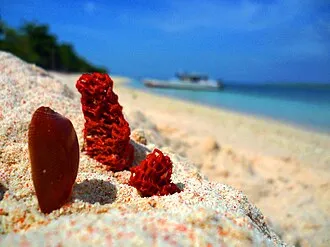 Pink Sand Beach
Great Santa Cruz Pink Beach
Zamboanga City, Zamboanga Peninsula
A rare pink sand beach just offshore from Zamboanga City, its color coming from pulverized red organ pipe coral mixed with white sand, reached by a short boat ride from the mainland.
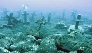 Volcanic Landmark
Camiguin Sunken Cemetery
Camiguin, Northern Mindanao
A cemetery submerged by an 1871 volcanic eruption, marked today by a large white cross rising from the water, on an island known as the Island Born of Fire.
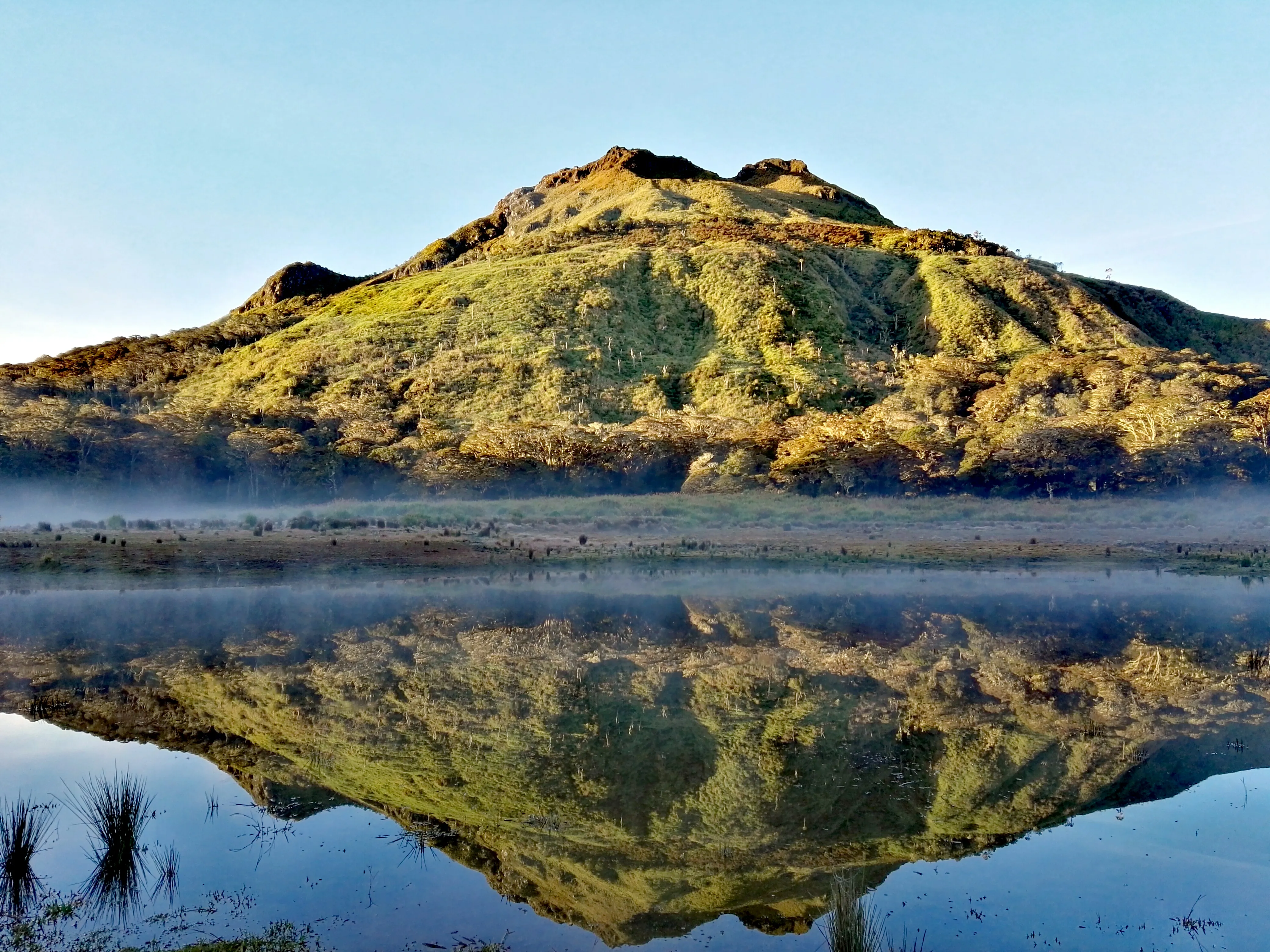 Highest Peak
Mount Apo
Davao del Sur, Davao Region
The highest mountain in the Philippines at 2,954 meters, a major multi-day trekking destination with several established trail routes and views that stretch to the Davao Gulf.
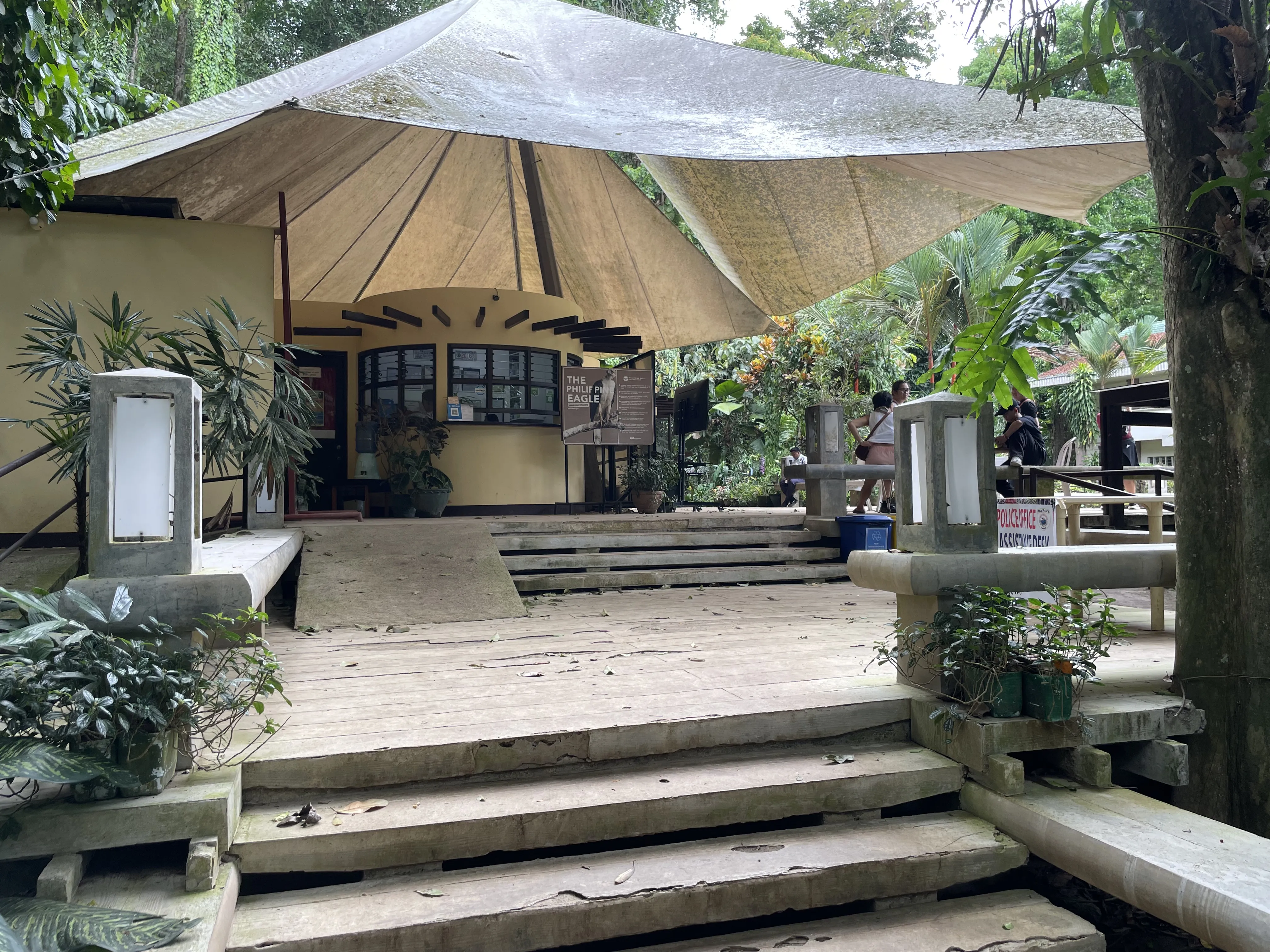 Wildlife Conservation
Philippine Eagle Center
Davao City, Davao Region
The primary breeding and conservation facility for the critically endangered Philippine Eagle, the national bird, set in a forested reserve in Davao City's Malagos area.
 Cultural Landscape
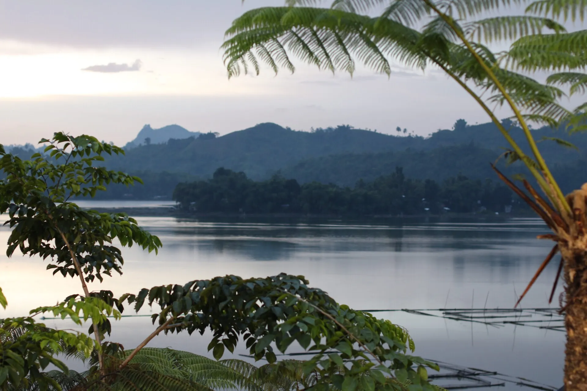
Lake Sebu
South Cotabato, SOCCSKSARGEN
Home to the T'boli community, known worldwide for T'nalak dreamweaving on abaca fiber, with seven waterfalls and zipline crossings around the lake.
 Surf Break
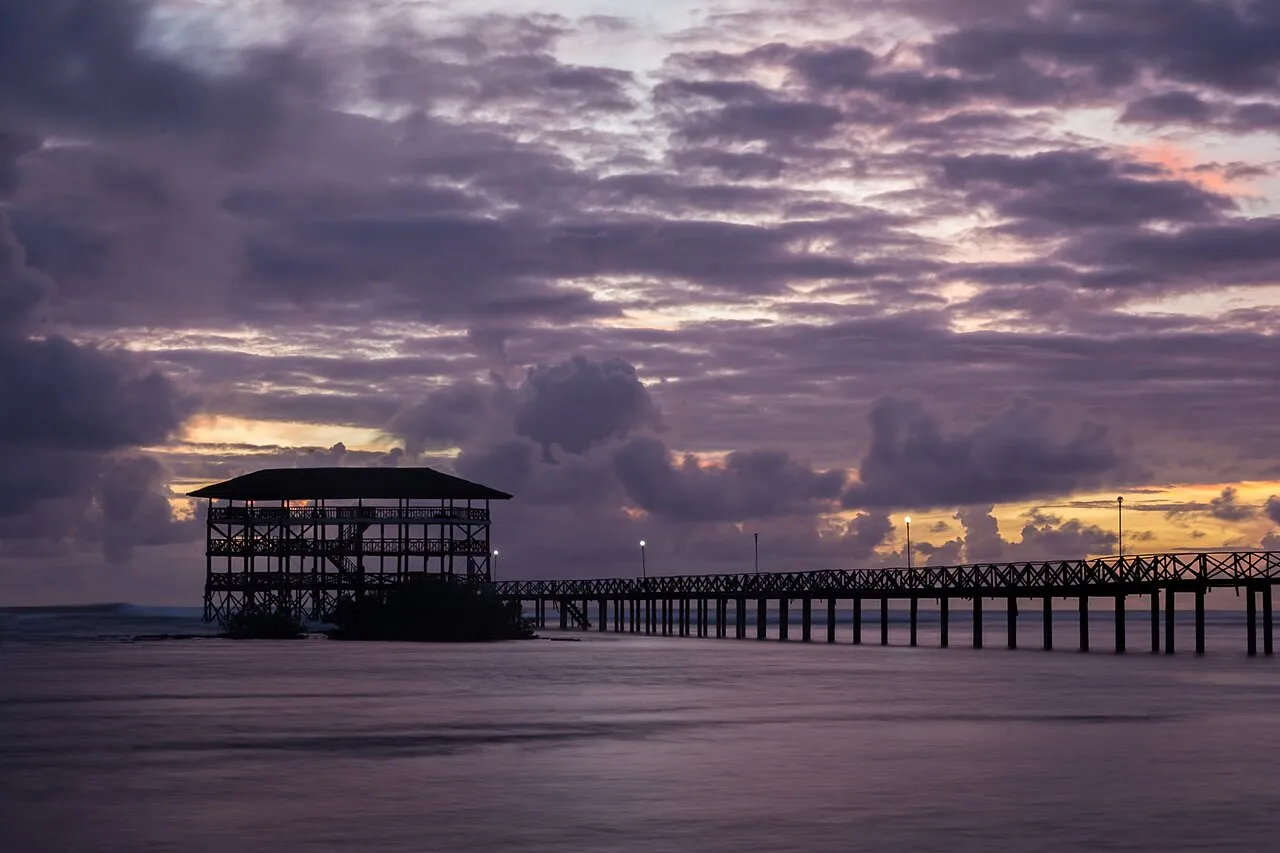
Siargao Cloud 9
Surigao del Norte, Caraga
A legendary reef break and the centerpiece of Siargao's reputation as the surfing capital of the Philippines, drawing surfers from around the world to its wooden boardwalk lineup.
 Waterfall
Tinuy-an Falls
Bislig, Surigao del Sur, Caraga
Often called the Little Niagara of the Philippines, a wide, multi-tiered waterfall cascading over limestone terraces into turquoise pools for swimming and bamboo raft rides.
 Sacred Lake
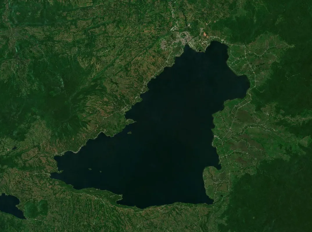
Lake Lanao
Lanao del Sur, BARMM
The second-largest lake in the Philippines and a sacred body of water for the Maranao people, ringed by lakeside communities known for brasswork and weaving.
Natural Landscapes
Natural Wonders and Adventure Destinations
Mindanao's terrain runs from volcanic islands to the country's tallest peak. Each region carries a distinct outdoor identity, from the surf breaks of Siargao and the summit trails of Mount Apo to the sacred lakes of the Bangsamoro interior.
Zamboanga Peninsula
Northern Mindanao
Davao Region
SOCCSKSARGEN
Outdoor Activities
Festivals in Mindanao
Mindanao festivals span harvest celebrations, indigenous tribal gatherings, and civic pageantry, expressed through elaborate costumes, competitive street dancing, and regional food.
Sinulog- and Dinagyang-style street dancing traditions also appear in Mindanao's own harvest and founding celebrations, blending settler, Lumad, and Moro influences unique to each province.
Getting There and Around
Traveling to and in Mindanao
Six main domestic airports, a network of ferry routes, and the Pan-Philippine Highway connect Mindanao internally and to the Visayas. Once on the ground, jeepneys, vans, habal-habal, and buses cover the rest.
Trip Planning Sequence
Eight steps to plan any Mindanao trip, from choosing a destination to checking festival dates before you leave.
Choose a Region or Destination
Pick a starting point, whether a single destination like Siargao...
Check Tourist Attractions
Identify anchor sites: Mount Apo, Lake Sebu, Camiguin, and Siarga...
Plan Things to Do
Go beyond the headline attraction: surfing, mountain trekking, la...
Find Restaurants
Each region carries its own food identity. Identify the regional...
Book Accommodations Early
Choose accommodation based on proximity to your main activities....
Sort Out Transportation
Identify your entry airport (Davao, Cagayan de Oro, Zamboanga, or...
Try Local Food and Specialties
Use the local cuisine section of each region page to find dishes...
Check Festivals and Events
Confirm whether a local festival falls within your travel dates,...
Travel Advisories
Mindanao sits largely outside the typhoon belt, making most of the island group a year-round destination unlike Luzon and the Visayas.
Siargao's best surf season runs from August to November when swells from the Pacific are at their strongest, while calmer conditions suit beginners from March to May.
Climbing Mount Apo requires a permit from the local government units around the mountain and is best arranged through a registered guide association in advance.
Check availability during Kadayawan in August and Kaamulan in February, when hotels in Davao City and Malaybalay fill up weeks in advance.
Plan overland travel time carefully. The Pan-Philippine Highway corridor between Surigao, Butuan, Davao, and General Santos covers long distances by bus.
Carry cash when visiting island destinations like Camiguin, Siargao's outer barangays, and remote parts of Tawi-Tawi. Digital payments are limited outside city centers.
Check current travel advisories before visiting Sulu, Basilan, and parts of Maguindanao and Lanao del Sur, where security conditions can vary by area.
Follow PHIVOLCS guidance near Camiguin's volcanic areas and Mount Apo, and confirm current access rules with the local tourism office before a climb.
People Also Ask About Mindanao
How many regions are in Mindanao?
Mindanao has 6 administrative regions: Region IX (Zamboanga Peninsula), Region X (Northern Mindanao), Region XI (Davao Region), Region XII (SOCCSKSARGEN), Region XIII (Caraga), and the Bangsamoro Autonomous Region in Muslim Mindanao (BARMM). Together they cover 28 provinces.
What is the population of Mindanao?
As of the 2020 Census, Mindanao had a population of 26,252,442, representing about 24.08% of the entire Philippine population, making it the third most populous island group. This reflected an annualized growth rate of 1.79% from the 2015 count of 24,135,775.
Which region in Mindanao has the most people?
Davao Region is the most populous region in Mindanao, with 5,243,536 residents in 2020, ahead of Northern Mindanao at 5,022,768 and SOCCSKSARGEN at 4,901,486. Caraga is the least populated at 2,804,788.
Is Sulu part of BARMM?
No. As of 2025, Sulu is part of Region IX (Zamboanga Peninsula). Following a Supreme Court ruling that affirmed Sulu's 2019 vote against the Bangsamoro Organic Law, Executive Order 91 transferred the province from BARMM to Region IX, the region it belonged to before the Autonomous Region in Muslim Mindanao was formed.
What is Mindanao most known for?
Mindanao is known for Siargao Island as the surfing capital of the Philippines, Mount Apo as the country's highest peak, Davao City's durian and the Philippine Eagle Center, the T'boli traditions of Lake Sebu, General Santos City as the tuna capital, and the Bangsamoro autonomous cultural identity.
What are the top tourist destinations in Mindanao?
Top destinations include Siargao for surfing, Davao City for Mount Apo and the Philippine Eagle Center, Camiguin for its volcanic landscape, Lake Sebu for T'boli culture, Zamboanga City for its pink-sand beach, and Cagayan de Oro for whitewater rafting.
How many provinces does Mindanao have?
Mindanao has 28 provinces across its 6 regions: 4 in Zamboanga Peninsula (including Sulu), 5 in Northern Mindanao, 5 in Davao Region, 4 in SOCCSKSARGEN, 5 in Caraga, and 5 in BARMM (Maguindanao del Norte, Maguindanao del Sur, Lanao del Sur, Basilan, Tawi-Tawi).
How many cities and municipalities are in Mindanao?
Mindanao has 33 cities, 422 municipalities, and 10,084 barangays across its 6 regions based on Philippine Statistics Authority data. BARMM holds the most municipalities at 97, while Davao Region has the fewest at 43.
Is Camiguin part of Mindanao?
Yes. Camiguin is a small volcanic island province in Northern Mindanao (Region X), administratively and geographically part of the Mindanao island group, reached by ferry from Balingoan in Misamis Oriental.
What is the main city of Mindanao?
Davao City is the primary economic and urban center of Mindanao, the largest city in the Philippines by land area, and home to Francisco Bangoy International Airport, the region's main international gateway.
What languages are spoken in Mindanao?
Cebuano is the most widely spoken language across Davao Region, Northern Mindanao, and Caraga. Other major languages include Chavacano and Tausug in Zamboanga Peninsula, Maranao in Lanao del Sur, Maguindanaon in Maguindanao, Yakan in Basilan, and over 18 Lumad indigenous languages across the highland interior.
What is the best time to visit Mindanao?
Mindanao sits largely outside the typhoon belt, making it a year-round destination. Most areas are best visited from December to May during the dry season. Siargao's best surf season runs from August to November, while Davao City and the Bukidnon highlands stay pleasant year-round.
How do you get to Mindanao from Luzon or the Visayas?
From Luzon, the main route is a domestic flight to Davao, Cagayan de Oro, Zamboanga, or General Santos. From the Visayas, FastCat ferries connect Liloan, Southern Leyte to Surigao City in about an hour, and 2GO/Supercat connect Cebu City to Cagayan de Oro in around 10 hours.
Are there businesses and service providers listed in Mindanao?
Yes, azifind lists 5,721 verified businesses across Mindanao's 6 regions, covering hotels, restaurants, retail, healthcare, financial services, and professional service providers, searchable by category and city.
Last verified: September 15, 2026. Population figures reflect the 2020 Census of Population and Housing. Geographic and administrative data follow the Philippine Statistics Authority PSGC 1Q 2026 release, with per-region figures reflecting the split of Maguindanao into two provinces and the 2025 transfer of Sulu from BARMM to Region IX (Zamboanga Peninsula) under Executive Order 91. About azifind.com →