
About the Visayas
The Visayas is the central island group of the Philippine archipelago, located between Luzon to the north and Mindanao to the south. It includes four administrative regions and is defined by an extensive inter-island maritime network, deep pre-colonial and Spanish colonial heritage, and some of the most visited natural and cultural destinations in Southeast Asia.
The island group covers a wide range of landscapes: the karst highlands and limestone cave systems of Samar, the volcanic interior of Negros, the agricultural plains of Panay, the limestone hill formations of Bohol, and the island destinations of Siquijor and Guimaras.
The Visayas contains some of the Philippines' best-known cultural and natural attractions, including the White Beach of Boracay, the Chocolate Hills, the heritage city of Cebu, the MacArthur Landing Memorial, and the marine reserve of Apo Island. In June 2024, the administrative map of the island group changed with the creation of the Negros Island Region under Republic Act 12000, bringing the Visayas to four regions.
Beyond travel, Azifind also lists businesses across the Visayas' regions, including restaurants, hotels, healthcare providers, financial services, retail businesses, transportation services, attractions, and other local service providers.
Explore by Region
Geographic Facts
Total Land Area
Mt. Kanlaon (Highest Peak)
Major Islands
Provinces
Major Islands
Samar
The largest island in the Visayas, covering Eastern, Northern, and Western Samar. Home to Sohoton National Park and the Calicoan surf area.
Negros
Divided into Negros Occidental and Negros Oriental, the sugarcane heartland of the Philippines and home to Kanlaon Volcano.
Panay
Covers Western Visayas, comprising Aklan, Antique, Capiz, and Iloilo. Known for Boracay in Aklan and heritage Iloilo City.
Leyte
Known for the Leyte Gulf landings of World War II and the MacArthur Landing Memorial in Palo. Kalanggaman Island lies off its northern coast.
Cebu
A long, narrow island and the economic heart of the Visayas, home to Metro Cebu, Oslob, Moalboal, and Mactan-Cebu International Airport.
Bohol
Known for the Chocolate Hills, the Philippine tarsier, Panglao Island beaches, and the Loboc River.
Siquijor
A small island province in the Negros Island Region, known for waterfalls, white-sand coves, the century-old balete tree, and folk healing traditions.
Bordering Waters
Sibuyan Sea
Between Luzon, the Visayas, and MIMAROPA
Philippine Sea
Pacific-facing, typhoon corridor for Eastern Visayas
Samar Sea
Between Samar, Leyte, and Luzon
Surigao Strait
Separates Leyte from Mindanao
Bohol Sea
Between Bohol, Cebu, Negros, and Mindanao
Sulu Sea
Western flank bordering MIMAROPA and Mindanao
Visayan Sea
Central inland sea between the main Visayan islands
Tañon Strait
Separates Cebu Island from Negros
Visayas Regions
All 4 administrative regions, each linking to a complete provincial and city-level directory with attractions, festivals, restaurants, and local food.
Western Visayas
Region VI
Anchored by Iloilo City and the world-famous White Beach of Boracay in Aklan. Th...
Central Visayas
Region VII
The economic engine of the island group, centered on Metro Cebu and the Mactan-C...
Eastern Visayas
Region VIII
Covers the historic island of Leyte, site of the MacArthur Landing Memorial in P...
Negros Island Region
NIR
The newest administrative region in the Philippines, established in June 2024 un...
Best Tourist Spots in the Visayas
Beaches, dive sites, cave systems, natural landmarks, and heritage districts spread across the Visayas' 4 regions.
 Beach
Beach
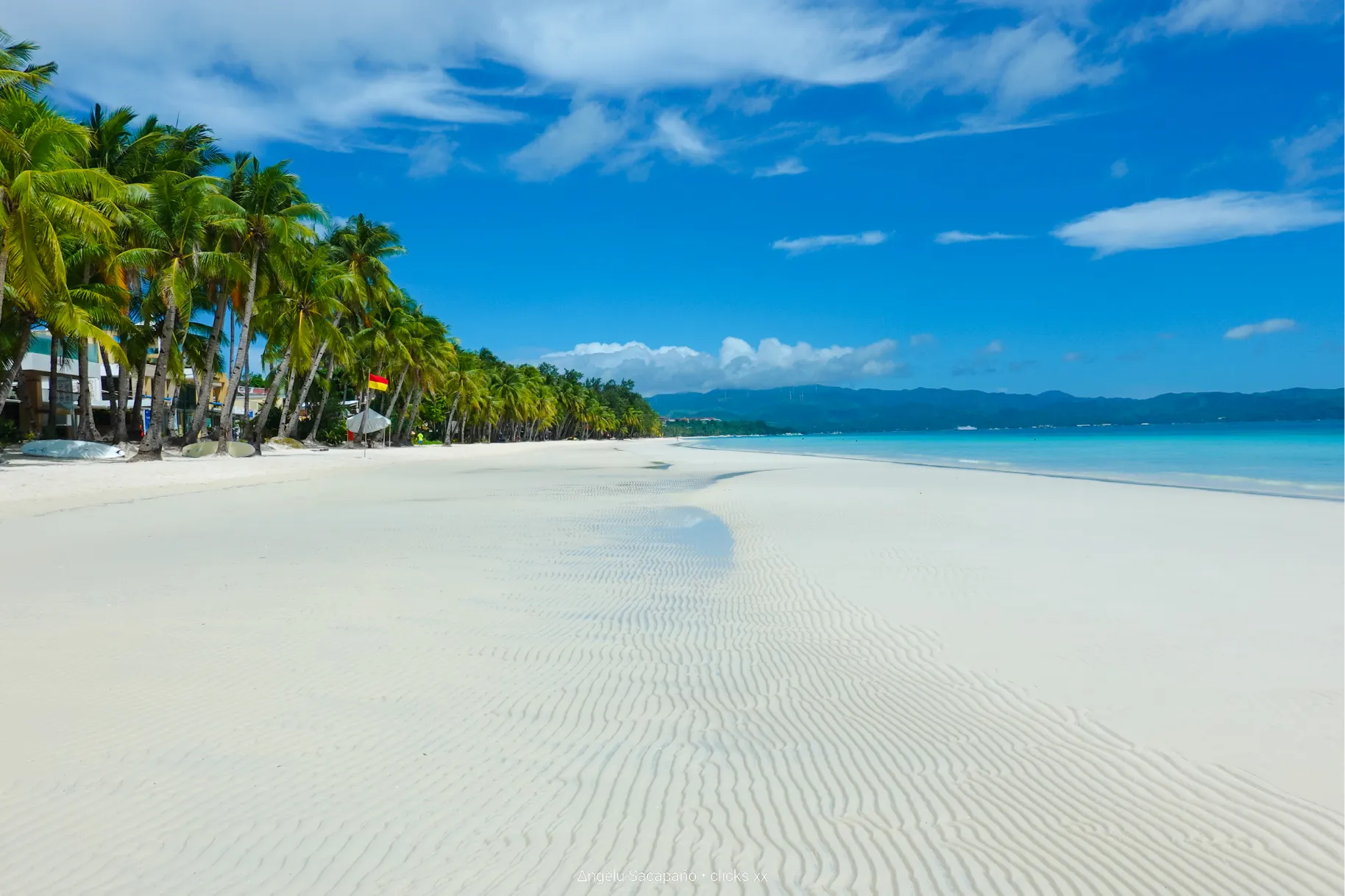
Boracay White Beach
Aklan, Western Visayas
One of the most celebrated beaches in the world, known for its powder-fine white sand, turquoise water, and a well-developed strip of resorts, restaurants, and sunset sailing tours along Station 2.
 Natural Landmark
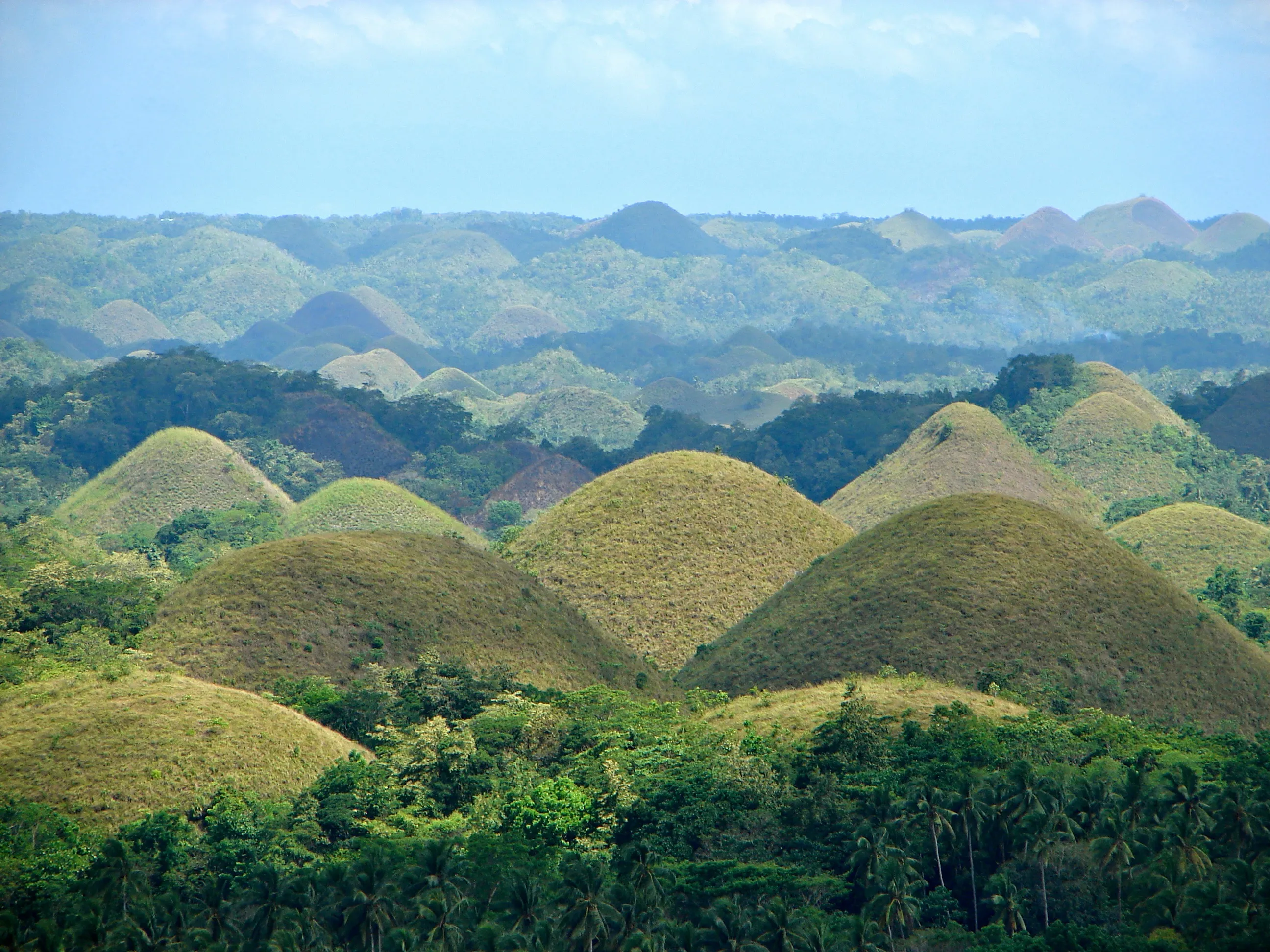
Chocolate Hills
Bohol, Central Visayas
Over 1,200 symmetrical grass-covered limestone hills that turn brown during the dry season. The viewpoint in Carmen offers the definitive panoramic view across the Bohol interior.
 Marine Encounter
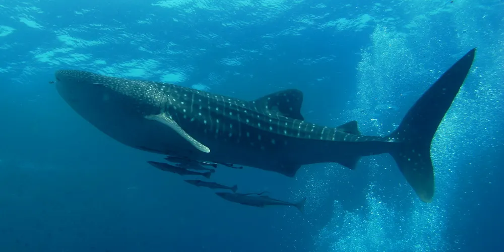
Oslob Whale Sharks
Cebu, Central Visayas
A community-managed site in southern Cebu where visitors snorkel or dive alongside whale sharks in shallow coastal waters, one of the most consistent whale shark encounters anywhere in the world.
 Island Sandbar
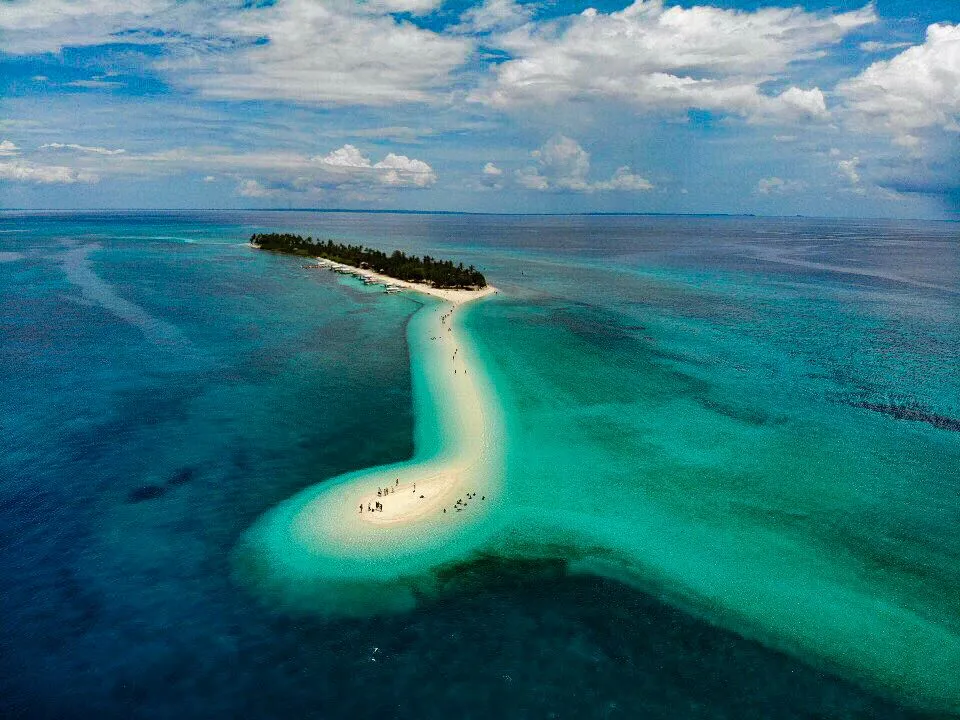
Kalanggaman Island
Leyte, Eastern Visayas
A slender sandbar island off Palompon with twin white-sand tips and clear turquoise shallows, popular for day trips, snorkeling, and permitted overnight camping.
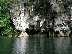 Cave System
Sohoton Natural Bridge and Caves
Samar, Eastern Visayas
A national park built around a natural limestone bridge and an extensive cave system, explored by paddleboat and on foot through chambers with stalactites and underground rivers.
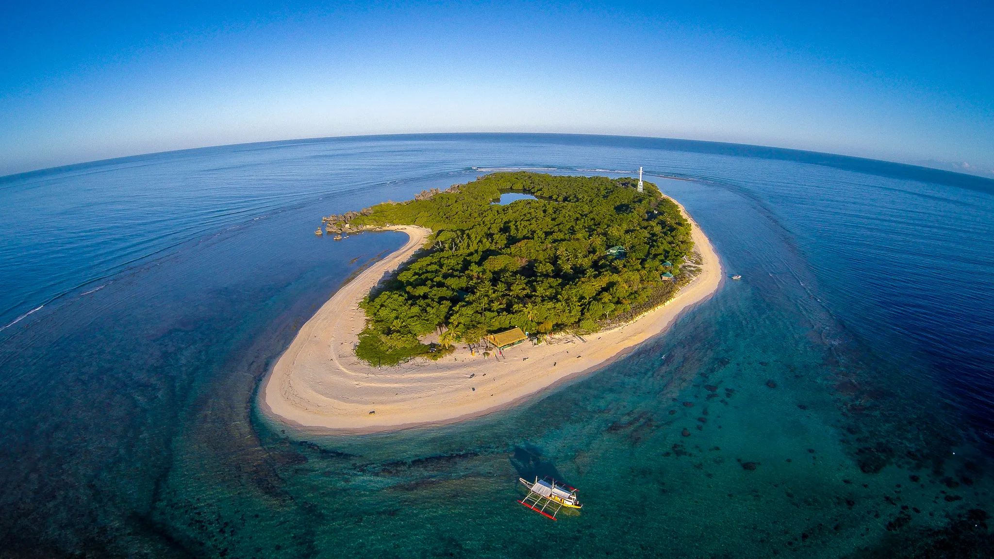 Diving Site
Apo Island
Negros Oriental, Negros Island Region
A small volcanic island and marine sanctuary off Dauin, considered one of the best places in the Philippines to snorkel or dive with sea turtles among well-preserved coral reefs.
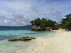 Island Getaway
Siquijor Island
Siquijor, Negros Island Region
Associated with folk healing and mysticism, Siquijor draws visitors for its waterfalls, white-sand coves, heritage balete tree, and a relaxed pace compared to busier Visayas destinations.
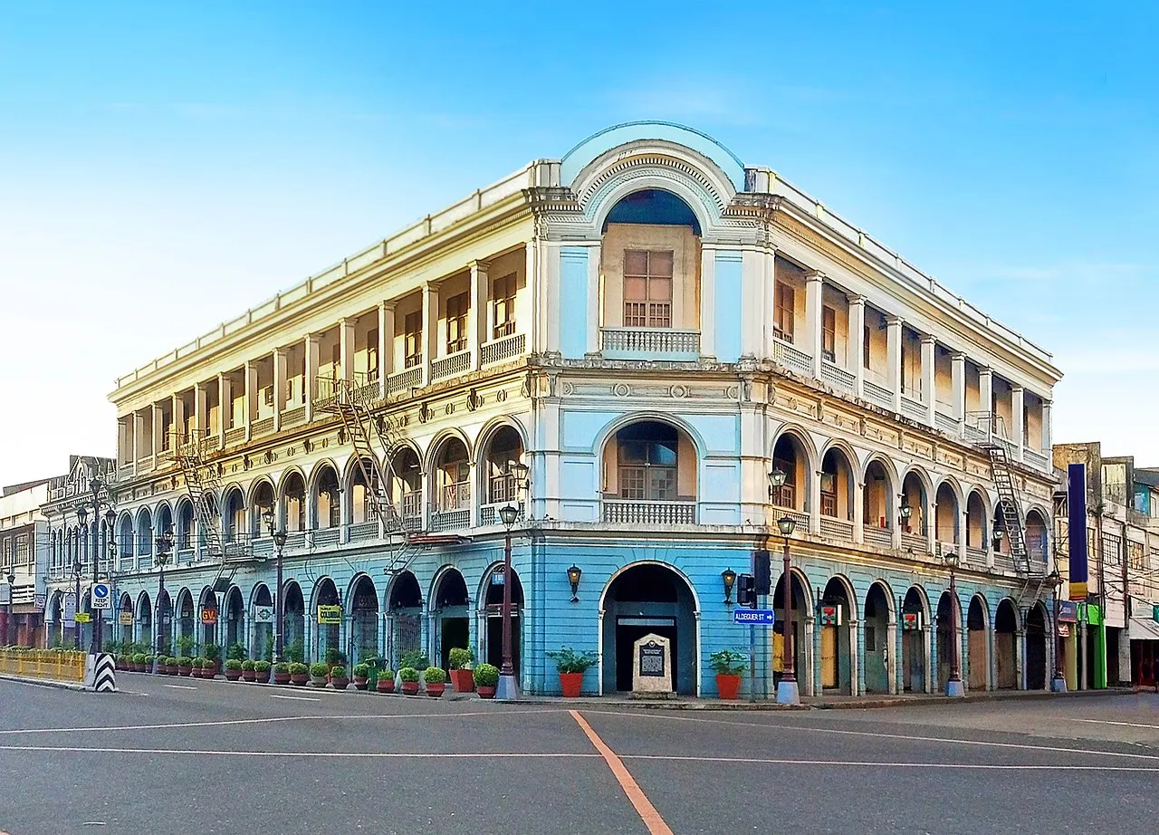 Heritage Site
Iloilo Heritage District
Iloilo City, Western Visayas
Centered on Calle Real, this district preserves rows of early 20th-century commercial architecture alongside colonial-era buildings, walkable with the restored Iloilo River Esplanade.
Beaches in the Visayas
Coastal destinations across all four regions, from Boracay's white sand and Panglao's dive resorts to the sandbars of Leyte and the coves of Siquijor.
Natural Landscapes
Islands and Marine Destinations
The Visayas is defined by its inter-island geography. Each major island group carries a distinct marine environment, from the coral walls of Apo Island and the sardine run of Moalboal to the cave systems of Samar and the sandbar islets of Leyte.
Western Visayas
Eastern Visayas
Negros Island Region
Outdoor Activities
Festivals in the Visayas
Visayas festivals rank among the largest in Southeast Asia. Each is rooted in religious devotion and tribal tradition, expressed through elaborate costumes, competitive street dancing, and regional food.
Ati-Atihan is celebrated in Kalibo, Aklan, Western Visayas, and is the oldest of the three festivals listed here. All three share roots in Santo Niño devotion and tribal identity.
Getting There and Around
Traveling to and in the Visayas
Six domestic airports and an extensive inter-island ferry network connect the Visayas to Luzon and Mindanao. Once on an island, jeepneys, vans, habal-habal, and buses cover the rest.
Trip Planning Sequence
Eight steps to plan any Visayas trip, from choosing a destination to checking festival dates before you leave.
Choose a Region or Destination
Pick a starting point, whether a single island like Bohol or Bora...
Check Tourist Attractions
Identify anchor sites: Chocolate Hills, Boracay White Beach, Oslo...
Plan Things to Do
Go beyond the headline attraction: island hopping, cave diving, w...
Find Restaurants
Each island carries its own food identity. Identify the regional...
Book Accommodations Early
Choose accommodation based on proximity to your main activities....
Sort Out Transportation
Identify your entry airport (Cebu, Iloilo, Kalibo, or Bacolod), t...
Try Local Food and Specialties
Use the local cuisine section of each region page to find dishes...
Check Festivals and Events
Confirm whether a local festival falls within your travel dates,...
Travel Advisories
Check weather conditions before visiting coastal destinations. The Pacific-facing eastern coast, including Eastern Visayas, is more exposed to typhoons from August through January.
Confirm ferry and fast-craft schedules before inter-island travel. Routes between Cebu, Bohol, Leyte, Negros, and Siquijor are operator-specific and can change with demand or weather.
Check availability during Sinulog in January, Dinagyang in late January, and MassKara in October. Hotels in Cebu City and Bacolod fill up weeks in advance.
Plan inter-island travel time carefully. What looks close on a map may require multiple ferry connections and several hours of total travel between islands.
Carry cash when visiting island destinations like Siquijor, Kalanggaman, and remote Samar communities. Digital payments are limited in smaller barangays.
Follow environmental guidelines in marine protected areas, particularly Apo Island, and beaches with designated swimming zones. Fines apply in most marine sanctuaries.
Check local advisories before visiting Kanlaon Volcano and areas near active geological zones. PHIVOLCS alert levels and LGU restrictions can limit access at any time.
The dry season from November to May is the best window for most Visayas destinations. Boracay, Cebu, and Bohol are at their best from December through April.
People Also Ask About the Visayas
How many regions are in the Visayas?
The Visayas has 4 administrative regions: Region VI (Western Visayas), Region VII (Central Visayas), Region VIII (Eastern Visayas), and the Negros Island Region (NIR). The NIR was created in June 2024 under Republic Act 12000, raising the count from three to four regions.
What is the population of the Visayas?
As of the 2020 Census, the Visayas had a population of 20,583,861, representing about 18.88% of the entire Philippine population. The figure reflects an annualized growth rate of 1.28% from the 2015 count of 19,373,431.
Which region in the Visayas has the most people?
Central Visayas is the most populous region in the Visayas, with 6,545,603 residents in 2020, ahead of the Negros Island Region at 4,760,337 and Western Visayas at 4,730,771. Eastern Visayas is the least populated at 4,547,150.
What is the newest region in the Visayas?
The Negros Island Region is the newest administrative region in the Philippines. It was established on June 11, 2024 under Republic Act 12000, drawing Negros Occidental from Western Visayas and Negros Oriental and Siquijor from Central Visayas. Bacolod and Dumaguete serve as its dual regional centers.
What is the Visayas most known for?
The Visayas is most known for the White Beach of Boracay in Aklan, the Chocolate Hills of Bohol, the Sinulog Festival of Cebu City, whale shark watching in Oslob, the MassKara Festival of Bacolod, Apo Island diving off Negros Oriental, and the heritage districts of Iloilo City and Cebu City.
What are the top tourist destinations in the Visayas?
Top destinations include Boracay for white sand beaches, Cebu and Bohol for heritage and nature, Panglao for diving, Oslob for whale shark snorkeling, Siquijor for its island character, Kalanggaman Island for its sandbar, and Iloilo City for heritage walks and Ilonggo food.
What are the beaches in the Visayas?
Major beach destinations span all four regions: Boracay and Guimaras in Western Visayas, Panglao, Moalboal, and Oslob in Central Visayas, Kalanggaman Island and Calicoan in Eastern Visayas, and Apo Island, Siquijor, and the Dumaguete coast in the Negros Island Region.
How many provinces does the Visayas have?
The Visayas has 16 provinces: 5 in Western Visayas (Aklan, Antique, Capiz, Guimaras, Iloilo), 2 in Central Visayas (Bohol, Cebu), 6 in Eastern Visayas (Biliran, Eastern Samar, Leyte, Northern Samar, Samar, Southern Leyte), and 3 in the Negros Island Region (Negros Occidental, Negros Oriental, Siquijor).
How many cities and municipalities are in the Visayas?
The Visayas has 39 cities, 369 municipalities, and 11,444 barangays across its 4 regions based on Philippine Statistics Authority data. The Negros Island Region holds 19 of the 39 cities, while Eastern Visayas has the most barangays at 4,390.
Is Boracay part of the Visayas?
Yes. Boracay is an island in the municipality of Malay, Aklan, which is a province of Western Visayas (Region VI). It is administratively and geographically part of the Visayas island group.
What is the main city of the Visayas?
Cebu City is the primary urban and commercial center of the Visayas, functioning as the second-largest metropolitan area in the Philippines after Metro Manila. It serves as a major shipping hub, international gateway, and IT-BPO center. Mactan-Cebu International Airport is the second-busiest airport in the country.
What languages are spoken in the Visayas?
The major regional languages are Cebuano, spoken across Central Visayas, eastern Negros, and parts of Eastern Visayas; Hiligaynon (Ilonggo), spoken across Western Visayas and western Negros; and Waray, spoken in Eastern Visayas. Other languages include Kinaray-a in Antique, Aklanon in Aklan, and Capiznon in Capiz.
What is the best time to visit the Visayas?
The dry season from November to May is the best window for most Visayas destinations. Boracay, Cebu, Bohol, and Panglao are at their best from December through April. Eastern Visayas, facing the Pacific, receives more rainfall year-round and is more exposed to typhoons from August through January.
How do you get to the Visayas from Luzon or Mindanao?
From Luzon, the main routes are by domestic flight to Cebu, Iloilo, Kalibo, or Bacolod, or by RORO ferry from Batangas to Caticlan or from Matnog, Sorsogon to Allen, Northern Samar. From Mindanao, FastCat ferries connect Surigao to Liloan, Southern Leyte in about an hour.
Are there businesses and service providers listed in the Visayas?
Yes, azifind lists 7,085 verified businesses across the Visayas' 4 regions, covering hotels, restaurants, retail, healthcare, financial services, and professional service providers, searchable by category and city.
Last verified: September 15, 2026. Population figures reflect the 2020 Census of Population and Housing. Geographic and administrative data follow the Philippine Statistics Authority PSGC 1Q 2026 release, with the four-region structure reflecting the creation of the Negros Island Region under Republic Act 12000 in June 2024. About azifind.com →