The Philippines sits at the collision point of the Philippine Sea Plate and the Eurasian Plate, one of the most seismically active junctions on the planet. PHIVOLCS classifies every volcano in the country into three tiers, active, potentially active, and inactive, and currently lists 24 as active.
This guide covers PHIVOLCS's classification system, then profiles each major active volcano on its own: geography, eruption history, and current status, the same structure encyclopedic references use for individual volcanoes, applied here across the whole country.
PHIVOLCS's Three-Tier Volcano Classification
Philippine Archipelago · All Regions
PHIVOLCS sorts every volcano in the country into one of three categories, based on eruptive history and physical condition rather than age alone. Active volcanoes have erupted within historical times, meaning the last 600 years with documented human accounts, or within the last 10,000 years based on dating of young volcanic deposits. PHIVOLCS currently lists 24 of these.
Potentially active volcanoes are morphologically young looking, with no historical or analytical record of an actual eruption. Inactive volcanoes have no recorded eruptions at all, and the landform itself shows heavy weathering, deep gullies, and softened contours.

azifind.com Travel
Philippine Geography Overview
Volcano Classification · All Regions 🌐
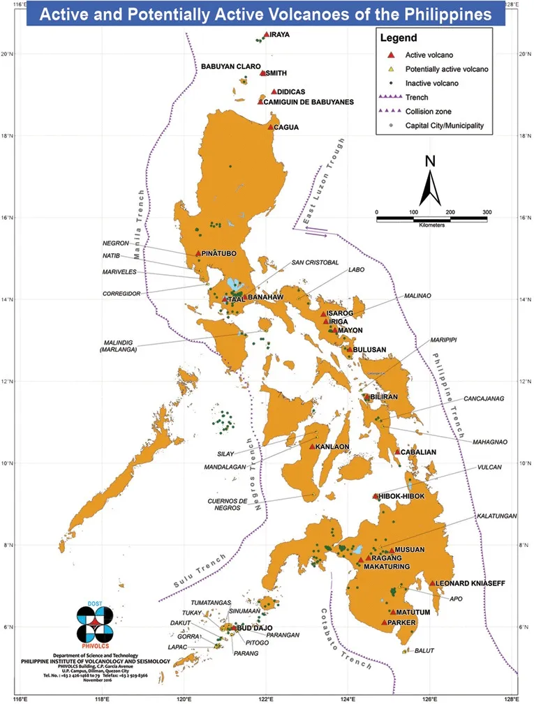
PHIVOLCS's official map of active and potentially active volcanoes, with trenches and collision zones marked. This is the map most sources leave the middle tier out of.
All 24 Active Volcanoes
Luzon, Visayas, Mindanao, Sulu Archipelago
PHIVOLCS's official active list runs to 24 volcanoes across four regions: 13 in Luzon, 3 in the Visayas, 7 in Mindanao, and 1 in the Sulu Archipelago. The six with enough eruption history and current activity to warrant their own profile, Mayon, Taal, Pinatubo, Kanlaon, Bulusan, and Hibok-Hibok, are covered in full further down this page. The full list, with province and general location, is below.
| # | Volcano | Latitude | Longitude | Province / Location | Region |
|---|---|---|---|---|---|
| 1 | Babuyan Claro | 19.52408 | 121.95005 | Babuyan Island Group, Cagayan | Luzon |
| 2 | Banahaw | 14.06038 | 121.48803 | Boundaries of Laguna and Quezon | Luzon |
| 3 | Biliran (Anas) | 11.63268 | 124.47162 | Leyte | Visayas |
| 4 | Bud Dajo | 6.01295 | 121.05772 | Sulu | Sulu Archipelago |
| 5 | Bulusan | 12.76853 | 124.05445 | Sorsogon, Bicol Region | Luzon |
| 6 | Cabalian | 10.27986 | 125.21598 | Southern Leyte | Visayas |
| 7 | Cagua | 18.22116 | 122.11630 | Cagayan | Luzon |
| 8 | Camiguin de Babuyanes | 18.83037 | 121.86280 | Babuyan Island Group, Cagayan | Luzon |
| 9 | Didicas | 19.07533 | 122.20147 | Babuyan Island Group, Cagayan | Luzon |
| 10 | Hibok-Hibok | 9.20427 | 124.67115 | Camiguin | Mindanao |
| 11 | Iraya | 20.46669 | 122.01078 | Batan Island, Batanes | Luzon |
| 12 | Iriga | 13.45606 | 123.45479 | Camarines Sur | Luzon |
| 13 | Isarog | 13.65685 | 123.38087 | Camarines Sur | Luzon |
| 14 | Kanlaon | 10.41129 | 123.13243 | Negros Oriental and Negros Occidental | Visayas |
| 15 | Leonard Kniaseff | 7.39359 | 126.06418 | Davao del Norte | Mindanao |
| 16 | Makaturing | 7.64371 | 124.31718 | Lanao del Sur | Mindanao |
| 17 | Matutum | 6.36111 | 125.07603 | Cotabato | Mindanao |
| 18 | Mayon | 13.25519 | 123.68615 | Albay, Bicol Region | Luzon |
| 19 | Musuan (Calayo) | 7.87680 | 125.06985 | Bukidnon | Mindanao |
| 20 | Parker | 6.10274 | 124.88879 | South Cotabato / General Santos / North Cotabato / Sarangani | Mindanao |
| 21 | Pinatubo | 15.14162 | 120.350845 | Boundaries of Pampanga, Tarlac and Zambales | Luzon |
| 22 | Ragang | 7.69066 | 124.50639 | Lanao del Sur and Cotabato | Mindanao |
| 23 | Smith | 19.53915 | 121.91367 | Babuyan Island Group, Cagayan | Luzon |
| 24 | Taal | 14.01024 | 120.99812 | Batangas | Luzon |
Linked names below jump to a full profile further down this page. Coordinates are PHIVOLCS's published summit locations. The remaining volcanoes on this list have no significant documented eruption history or current activity beyond their PHIVOLCS classification, so they're listed here for completeness rather than given individual sections.
Mayon Volcano
Albay, Bicol Region · Active · Currently Erupting

Volcano Profile
Mayon Volcano
Elevation
2,462 m (8,077 ft)
Coordinates
13.25519, 123.68615
Province
Albay, Bicol Region
Geography
Mayon dominates the city of Legazpi in Albay province, southeastern Luzon. Often called the world's most perfect volcanic cone for the symmetry of its shape, it has a base roughly 80 miles (130 km) in circumference and rises to 8,077 feet (2,462 meters) from the shores of Albay Gulf. Mayon Volcano National Park covers 21 square miles (55 sq km) around it, and large abaca plantations grow on its lower slopes.
History
Mayon holds the highest historical eruption count of any Philippine volcano, with roughly 47 recorded eruptions since 1616. Its most destructive eruption struck in 1814, when ballistic projectiles killed around 1,200 people in the town of Cagsawa. Survivors resettled and founded what's now Daraga, and the car-sized boulders still scattered around the Cagsawa Ruins date from that eruption. A 1993 eruption killed 79 people, and in December 2006, Typhoon Durian sent heavy rain onto Mayon's ash-covered slopes, triggering lahars and floods that killed more than 1,000.
Recent Activity
Mayon has been in an ongoing effusive eruption since January 2026, still active as of this writing, the longest-running of the country's current active phases. A standing 6-kilometer Permanent Danger Zone around the volcano triggers evacuation whenever unrest picks up. Check PHIVOLCS's current volcano bulletin for Mayon's live alert level before planning a visit near the base.
Taal Volcano
Batangas, Calabarzon · Active · Ongoing Unrest
Volcano Profile
Taal Volcano
Elevation
311 m (1,020 ft)
Coordinates
14.01024, 120.99812
Province
Batangas
Geography
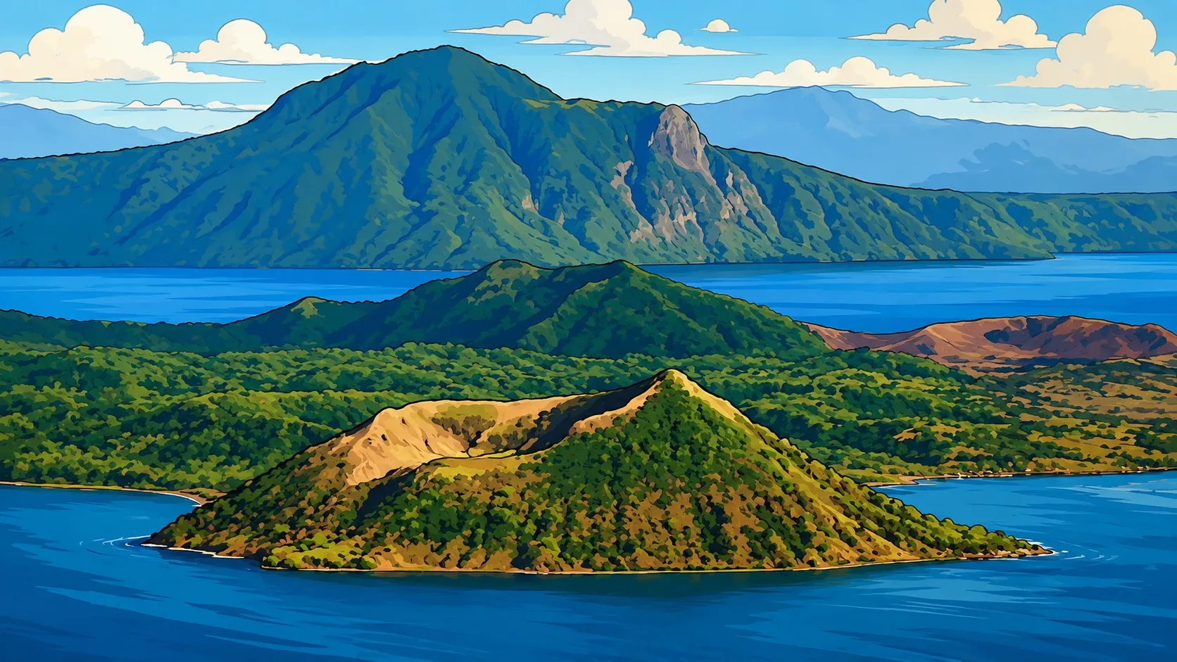
Taal sits inside Taal Lake in Batangas, about 50 kilometers south of Manila. Its configuration is unusual even by volcanic standards: a lake containing Volcano Island, which itself contains a crater lake, a lake-within-an-island-within-a-lake arrangement that makes it one of the most photographed inland features in the country.
History
Taal has erupted more than 30 times since the 16th century. Its most destructive eruption ran for roughly seven months in 1754, burying four Batangas towns under as much as 40 inches of ash in some areas. Later eruptions in 1911 and 1965 killed 1,335 and roughly 190 people respectively, cementing Taal's reputation as one of the most consistently dangerous volcanoes in the country despite its modest size.
Recent Activity
Taal's most recent major eruption, in January 2020, sent a phreatomagmatic ash column roughly 14 kilometers high, deposited ash across Batangas, Cavite, and Metro Manila, and forced the evacuation of close to a million people, with PHIVOLCS raising the alert to Level 4. Since April 2024, Taal has cycled through near-continuous phreatic and phreatomagmatic activity, with the most recent recorded events in July 2026. Check PHIVOLCS's bulletin for the current alert level before visiting.
Mount Pinatubo
Zambales, Tarlac & Pampanga tripoint · Active · Dormant Since 2021

Volcano Profile
Mount Pinatubo
Elevation
1,486 m (4,875 ft)
Coordinates
15.14162, 120.350845
Province
Pampanga, Tarlac & Zambales
Geography
Pinatubo sits at the tripoint of Zambales, Tarlac, and Pampanga provinces in the Zambales Mountains, part of the Cabusilan sub-range. Before 1991 it stood 1,745 meters (5,725 ft) above sea level, only about 600 meters above the surrounding plains, which largely obscured it from view. The 1991 eruption collapsed its summit into a caldera, lowering its current elevation to 1,486 meters (4,875 ft). It's about 87 kilometers northwest of Manila, and the former Clark Air Base sat just 14 kilometers east of its summit.
History
Geologists distinguish "ancestral" Pinatubo, active from roughly 1.1 million years ago, from "modern" Pinatubo, born around 79,000 BC in an eruption estimated at five times the scale of 1991. Modern Pinatubo then erupted episodically roughly every few thousand years, with its most recent pre-1991 eruptive period around 1500 AD, after which it lay dormant for nearly 500 years, its slopes fully covered in rainforest, largely unrecognized as a volcano by the people living around it.
The June 15, 1991 eruption was the second-largest terrestrial eruption of the 20th century, after Novarupta in Alaska in 1912. It released roughly 10 cubic kilometers of magma and 20 million tonnes of sulfur dioxide, sent an ash column 35 kilometers into the atmosphere, and coincided with Typhoon Yunya, which mixed rain into the ashfall. Global temperatures dropped by about 0.5°C over the following two years. Minor dome-forming eruptions continued inside the new caldera through 1993, and the caldera itself filled with monsoon rain to form Lake Pinatubo, later partially drained by controlled release in 2001 over concerns about crater wall stability.
Recent Activity
Pinatubo's most recent recorded activity was a weak phreatic explosion on November 30, 2021, produced by hydrothermal fluids near the surface rather than fresh magma. PHIVOLCS had raised Alert Level 1 in March 2021 after a spike in seismic activity, then stepped it back down to Level 0 by August 2021 once earthquake frequency returned to baseline. The volcano is now a hiking and tourism destination, most commonly accessed via Barangay Santa Juliana in Capas, Tarlac.
Cultural note: local Aeta communities have long associated Pinatubo with Apo Namalyari, a guardian deity. Some 7,000 Aeta families were formally granted a Certificate of Ancestral Domain Title over the Zambales side of the volcano, including its summit, in 2010.
Kanlaon Volcano
Negros Oriental & Negros Occidental · Active · Ongoing Explosive Phase
Volcano Profile
Kanlaon Volcano
Elevation
2,435 m (7,988 ft)
Coordinates
10.41129, 123.13243
Province
Negros Oriental & Negros Occidental
Geography
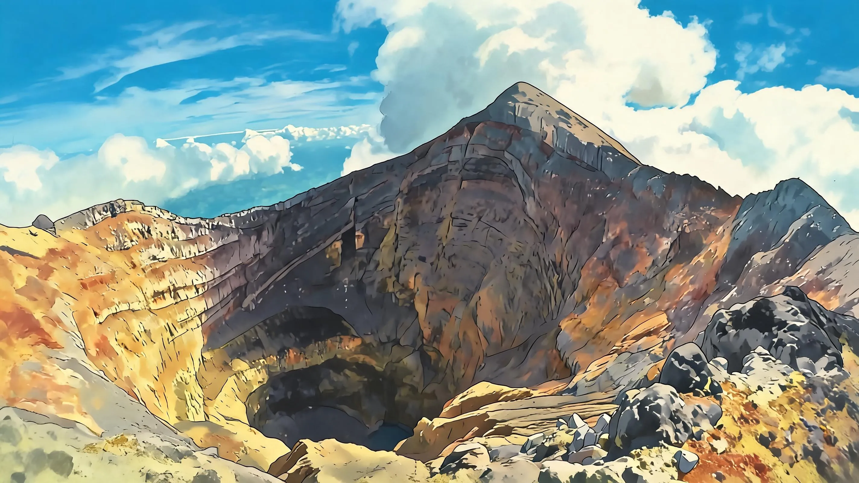
Kanlaon straddles the border of Negros Oriental and Negros Occidental in the Visayas, and is the region's most active volcano. Its summit reaches 2,435 meters, making it the highest peak in the Visayas, with a crater roughly 400 meters deep and 100 meters in diameter at the top.
History
Kanlaon has erupted roughly 30 times since 1819, making it one of the more frequently active volcanoes in the country, even though its individual eruptions have generally been smaller in scale than Mayon's, Taal's, or Pinatubo's.
Recent Activity
Kanlaon has been through an extended explosive and Vulcanian phase since June 2024, with repeated ash emissions and explosive events running into 2026. Its trails, when open, require a permit and guide from the DENR, and access is subject to closure during periods of unrest.
Bulusan Volcano
Sorsogon, Bicol Region · Active
Volcano Profile
Bulusan Volcano
Elevation
1,565 m (5,135 ft)
Coordinates
12.76853, 124.05445
Province
Sorsogon, Bicol Region
Geography
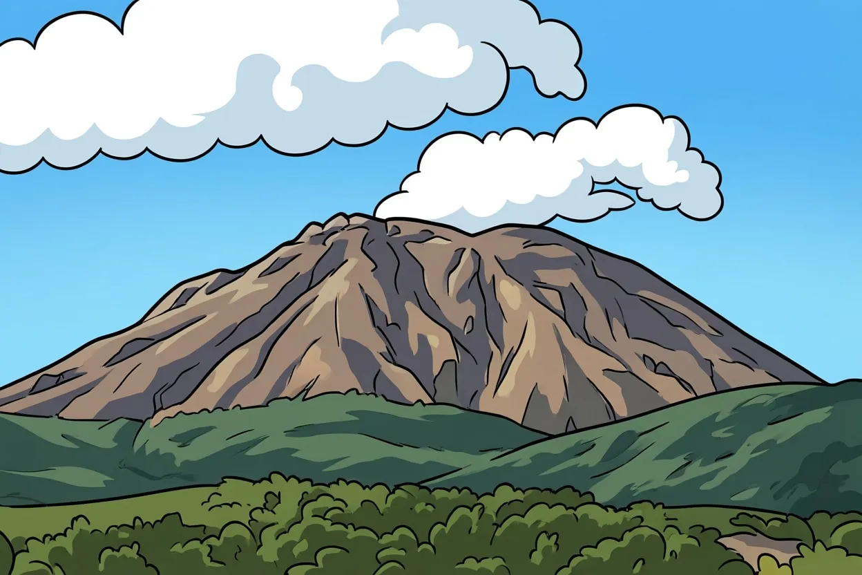
Bulusan sits at the southern tip of Luzon in Sorsogon province, part of the Bicol Region's cluster of active volcanoes alongside Mayon.
History
Bulusan has erupted roughly 15 times since 1885, and is characterized by sudden, steam-driven phreatic eruptions rather than the sustained lava effusion associated with Mayon.
Recent Activity
Bulusan's most recent phreatic eruption occurred on April 28 and 29, 2025. It remains under close PHIVOLCS monitoring given its history of sudden, relatively short-notice steam explosions.
Camiguin and Hibok-Hibok
Camiguin, Mindanao · 1 Active of 7 Volcanoes on the Island

Volcano Profile
Hibok-Hibok
Elevation
1,332 m (4,370 ft)
Coordinates
9.20427, 124.67115
Province
Camiguin
Geography
Camiguin, off the northern coast of Mindanao, packs seven volcanoes into just 238 square kilometers, the highest concentration of volcanoes per square kilometer of any island on Earth. Only Hibok-Hibok, at 1,332 meters, is currently classified active; the other six, including Mount Timpoong, the island's tallest at over 1,700 meters, and Mount Vulcan, are dormant or inactive.
History
Hibok-Hibok's 1871 eruption triggered earthquakes severe enough to sink part of a town, cemetery included, now the Sunken Cemetery tourist site marked by a cross visible from shore. Its most recent major eruptions, between 1948 and 1951, caused serious damage and loss of life, and formed the crater now filled by a green lake near the summit.
Recent Activity
Hibok-Hibok has been quiet since its early 1950s eruptions but remains classified active by PHIVOLCS. Climbing it requires a DENR permit and guide, with the standard route ascending from Ardent Hot Springs in Mambajao and taking three to five hours to the summit.
How PHIVOLCS Alert Levels Work
All Active Volcanoes · PHIVOLCS Monitoring System
PHIVOLCS monitors every active volcano in the country on a six-tier alert scale, from Level 0 (background quiet) to Level 5 (a major eruption actively underway). Each step up reflects escalating earthquake activity, gas emissions, and ground deformation specific to that volcano, and each carries its own recommended public response, from routine preparedness at Level 0 up to evacuation orders extending well beyond the summit at Level 4 and 5.
The general framework below shows what each level typically represents. Exact monitoring criteria, and the specific evacuation radius tied to each level, are calibrated individually per volcano based on its own eruptive history and hazard mapping, so the same number can mean a somewhat different radius or response depending on whether it's posted for Mayon, Taal, or Pinatubo.
| Level | Status | What It Means | Typical Public Response |
|---|---|---|---|
| 0 | Normal | Background seismicity and gas flux. No eruption expected in the foreseeable future. | Communities continue routine preparedness. |
| 1 | Low-level unrest | Earthquake clusters and changes in crater or fumarole gas chemistry. Hydrothermal or tectonic activity, no eruption imminent. | Extreme caution advised for anyone entering the summit crater or caldera. |
| 2 | Increasing unrest | Shallowing earthquake activity, rising gas flux, weak phreatic explosions, and detected ground deformation. Possible deep magmatic intrusion. | No entry into the crater or caldera. Communities begin preparing for possible escalation. |
| 3 | Intensified / magmatic unrest | Shallow earthquake swarms, sustained gas emission, ground inflation. Magmatic intrusion likely, higher chance of a major eruption. | Evacuation of upland communities within a set radius of the summit. |
| 4 | Hazardous eruption imminent | Strong, shallow earthquakes, continuous ash emission, intense ground deformation. A highly explosive eruption possible within hours to days. | Evacuation of all communities within pre-set hazard zones for pyroclastic flows, ashfall, and lahars. |
| 5 | Highly hazardous eruption in progress | Sustained explosive eruption, potentially with an eruption column reaching well into the stratosphere. Hazards expected within a wide radius and downwind of the plume. | Evacuation extends further downwind and along major river systems. |
This is the general PHIVOLCS alert framework; Mayon, Taal, Pinatubo, and every other active volcano each have their own calibrated version of it. Always check PHIVOLCS's current volcano bulletin for the specific volcano and level in question rather than assuming a level's meaning carries identically across volcanoes.
What Actually Makes a Volcano Dangerous
Direct & Indirect Hazards · PHIVOLCS Classification
PHIVOLCS separates volcanic hazards into two groups. Directly tied to eruption: lava flow, tephra fall and ashfall, ballistic projectiles, pyroclastic density currents (the fast-moving mix of hot gas and ash that's the deadliest of all volcanic hazards), lateral blasts, and volcanic gas emissions. Indirect hazards often arrive after the eruption has passed: lahars, debris avalanches, volcanic tsunamis, ground subsidence, and secondary explosions when hot deposits meet water later on.
Lahars are worth flagging specifically for anyone living near a Philippine volcano rather than just visiting. They can happen years after an eruption, whenever heavy rain remobilizes loose ash sitting on a volcano's slopes, which is part of why areas around Pinatubo and Mayon still carry lahar risk long after the eruptions that produced the ash in the first place.
azifind.com Travel
Philippine Geography Overview
Volcanic Hazards · All Regions 🌐
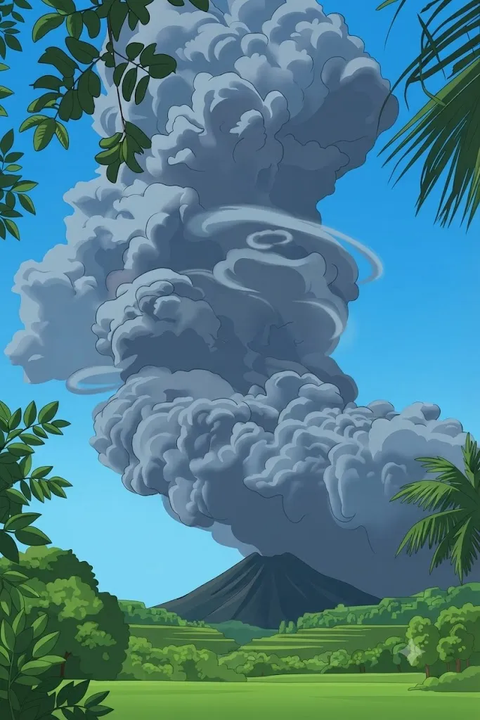
Volcanic ash deposited during an eruption can turn deadly years later, once rain remobilizes it into a lahar.